The geotechnical crew rolls out a spread of geophones and a seismic source truck along a quiet street in the Eagle Glen neighborhood, preparing to measure shear-wave velocity profiles for a new residential development. In Corona California, where the 15 Freeway corridor cuts through the Peninsular Ranges batholith and the alluvial fans of the Santa Ana River, the near-surface geology shifts abruptly from weathered granitic rock to deep, loose sands and gravels. This kind of variability demands a thorough seismic microzonation before any structural design begins, because a one-size-fits-all site class can lead to under-designed foundations or unnecessary over-design. We deploy active MASW arrays and passive HVSR recordings to capture Vs30 values at every corner of the parcel, then correlate those readings with existing borehole data from nearby projects. Before we finalize the zonation, we often recommend a complementary MASW Vs30 survey to validate the shear-wave profile across the entire lot, especially where the topography suggests a buried channel or a transition zone between rock and sediment.
A site class shift from C to D can change the design base shear by 30 percent, turning a safe design into a code violation overnight.
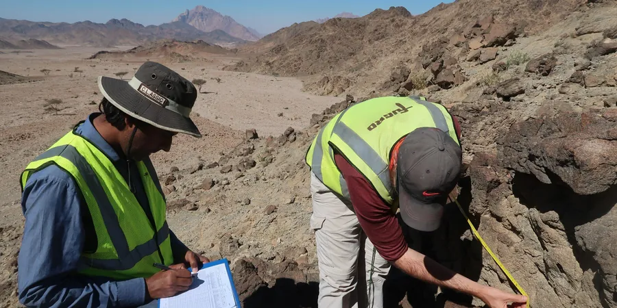
Methodology applied in Corona California
Typical technical challenges in Corona California
The alluvial fans that spread out from the Santa Ana River and Temescal Wash are composed of poorly graded sands with intermittent clay lenses, and the water table in many parts of western Corona sits at just 8 to 12 feet below grade. During a major earthquake on the San Jacinto or Elsinore fault zones, those loose sands can lose shear strength and flow laterally, dragging foundations and utility lines with them. We have seen post-event reconnaissance from the 1987 Whittier Narrows and the 1994 Northridge earthquakes where similar alluvial deposits in the Inland Empire experienced differential settlement and lateral spreading that cracked slabs and misaligned tilt-up panels. A proper seismic microzonation in Corona California identifies these high-risk pockets early, so the structural engineer can specify ground improvement, deeper foundations, or a different site class assumption before the permit is issued.
Our services
We tailor the microzonation scope to the specific needs of each project in Corona California, from single-family lots to large commercial campuses.
Full Vs30 Mapping with MASW & HVSR
Active MASW arrays with 24 geophones and a tracked seismic source cover up to 10 acres per day, while passive HVSR stations run overnight to capture the low-frequency signature of deep basin fill. The final report includes a contour map of Vs30 values, site class boundaries, and recommended spectral acceleration coefficients for each zone.
Liquefaction Hazard Zonation
For parcels within the Santa Ana River floodplain or near Temescal Wash, we combine the microzonation with SPT-based liquefaction triggering analyses using the Youd-Idriss (2001) methodology. The output is a liquefaction potential map that shows which zones require mitigation such as stone columns or deep soil mixing.
Frequently asked questions
What is the difference between seismic microzonation and a standard site class per ASCE 7?
A standard site class lumps an entire property into a single letter grade (B, C, D, E) based on the average Vs30 across the top 100 feet, but seismic microzonation divides the same property into multiple zones with distinct site classes and response spectra. In Corona California, where the geology can change from granitic rock to alluvial sand within 200 feet, a single site class might overestimate the demand on the rock portion or underestimate it on the soil portion. Microzonation gives the structural engineer a precise map so each foundation element can be designed for the actual ground motion at its location.
How much does a seismic microzonation study cost for a typical 5-acre commercial lot in Corona?
For a 5-acre lot with moderate topographic variation, the cost typically ranges between US$4,270 and US$19,050, depending on the number of MASW lines, the need for downhole seismic logging, and the level of liquefaction analysis required. The price includes field testing, laboratory correlation, and a report with contour maps and spectral acceleration tables. We can provide a firm quote after a brief site visit and review of existing subsurface data.
How long does a microzonation field campaign take for a hillside development in the Eagle Glen area?
A typical hillside development of 20 to 30 lots requires two to three days of field work: one day for MASW lines along the proposed road corridors, one day for HVSR stations on the building pads, and a half-day for any additional seismic cone or downhole testing if the bedrock is deeper than expected. Data processing and report writing take another two weeks. We always coordinate with the grading contractor to avoid conflicts with earth-moving equipment.